As the hot, sweaty days of summer begin to give way to the cool days of autumn, the time is right for getting outdoors and exploring some of the beautiful hikes that Central Virginia has to offer. When I’m not working at Parks and Recreation, I love to take the time to get outside and explore the trails, and are lucky enough to live in an area with a variety of options for hiking. Although I haven’t hiked all of them (yet), I’d like to share some of my favorite hikes in the area! Also, don’t forget that you can always sign up for our naturalist-led day hikes if venturing off on your own isn’t your thing!
Alpine Trail | Easy to Moderate Difficulty | Not Good for Small Children
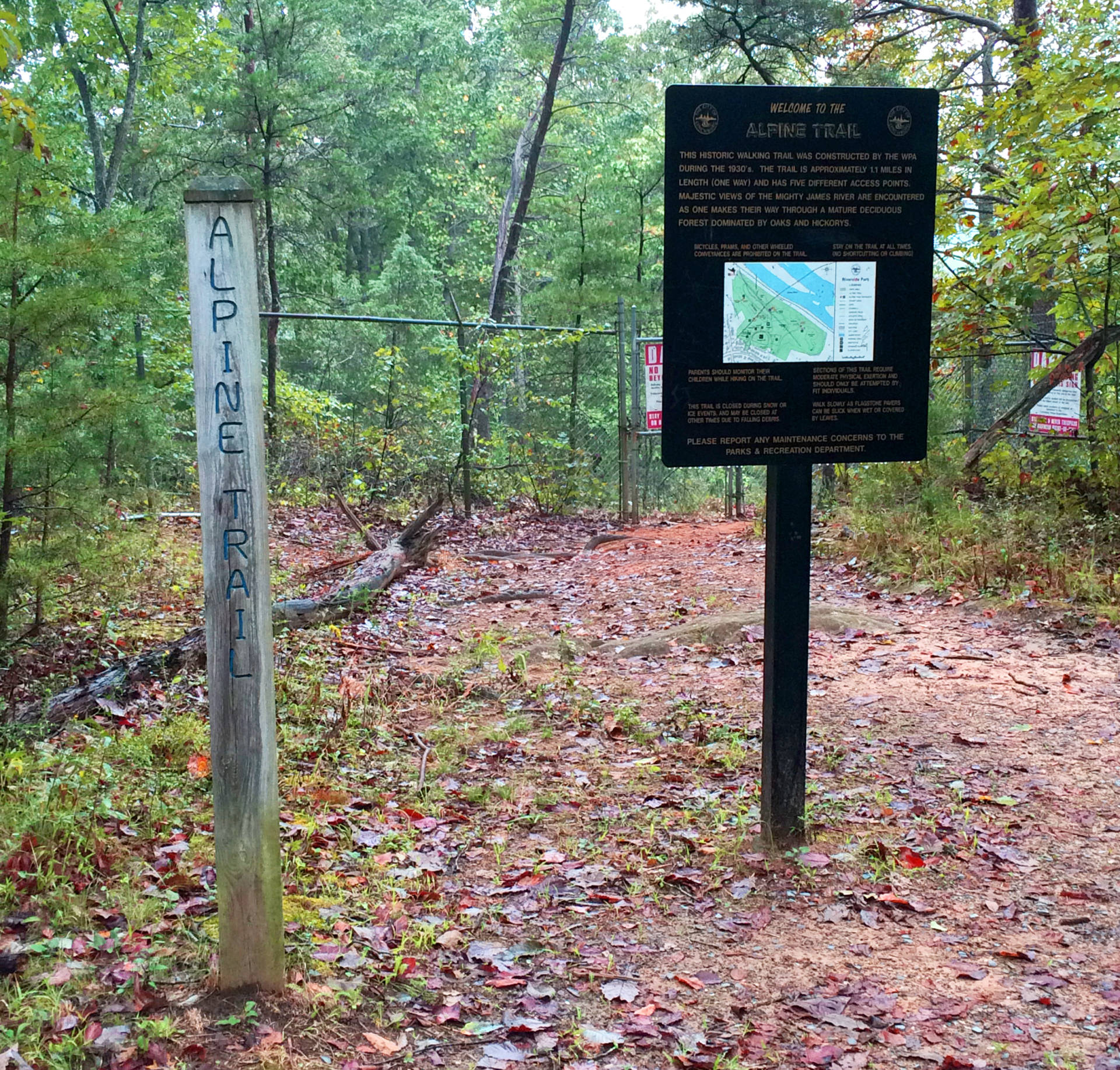
Alpine Trail entrance sign near the railroad bridge.
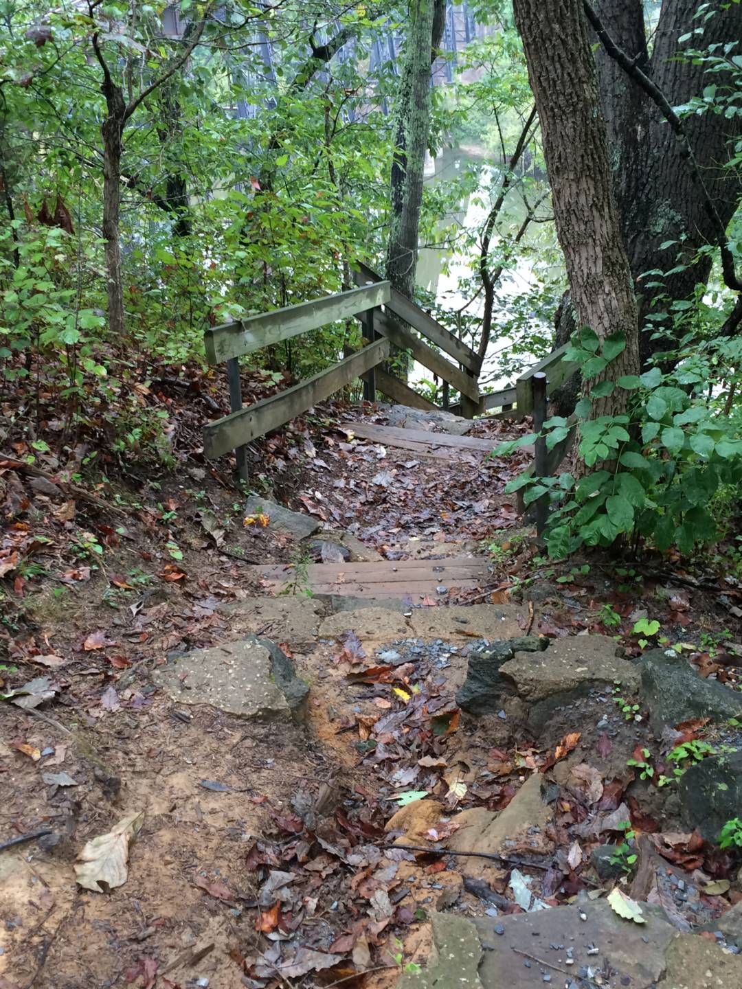
One entrance to the Alpine Trail that will take you past the James River.
Nestled within Riverside Park is a trail that offers fantastic views of the James River and frequent sightings of birds and other wildlife. I’m talking about the Alpine Trail. There are several entrances in the park which are clearly marked with signs.
My favorite section of this trail is the part that passes underneath the Overlook on to the James River. You can take this all the way to the other end of the park by the Railroad bridge. In between, there’s even a bench to take a break. I recommend doing this hike at sunset so that you can catch some awesome views of the sun setting over the James.
The beauty of this trail is that different sections offer different levels of difficulty. The section that overlooks the James River includes more steep and rocky sections. However, the portion that goes around the other side of the park offers more level ground.
Use caution when hiking this trail; I don’t recommend it for small children because right off of the trail there are many steep drops. For this reason, straying off of the trail is extremely dangerous. It is, however, a nice place to take an after-dinner hike with the family before the sun sets.
Crabtree Falls | Easy to Moderate Difficulty | Good for Children
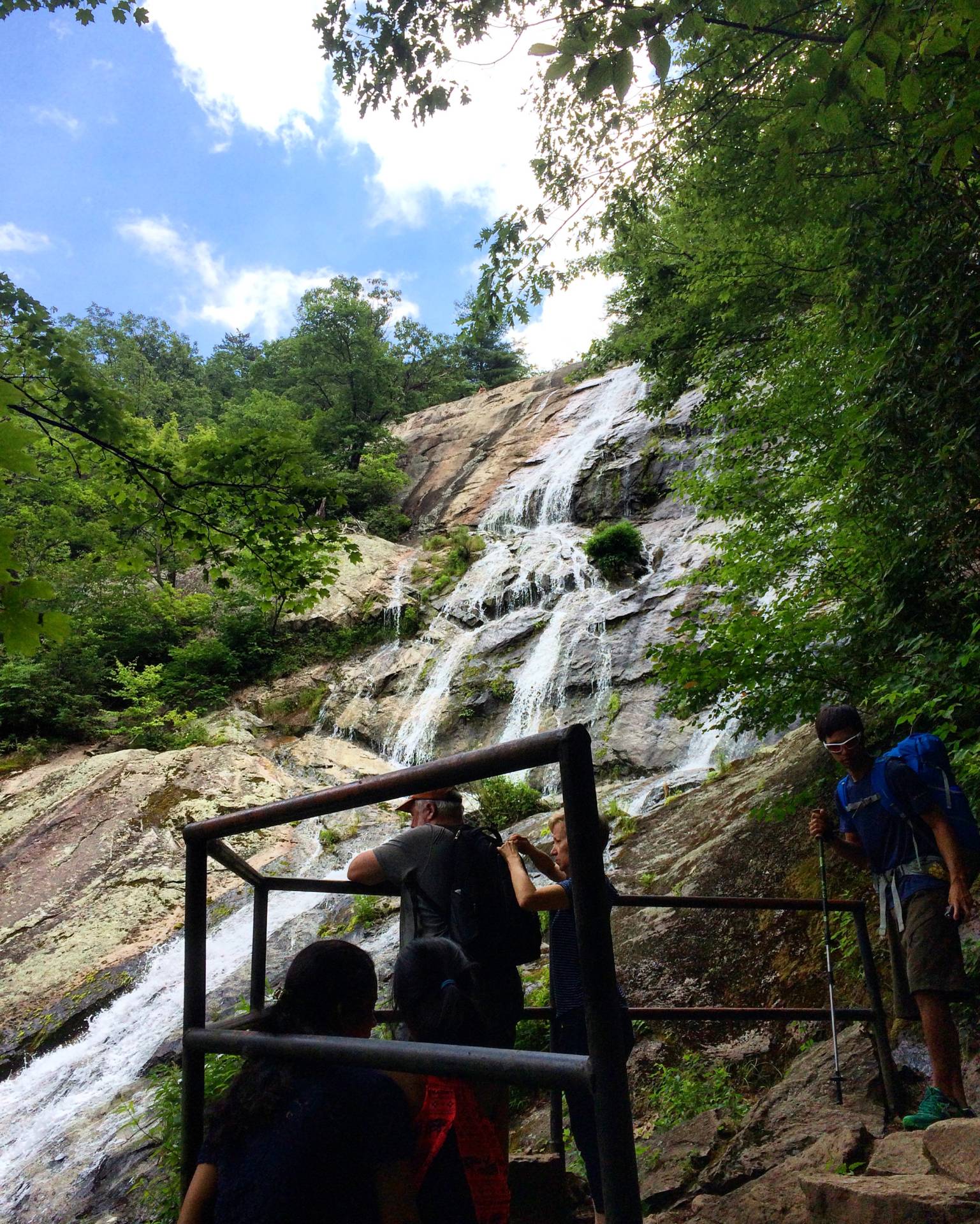
One of the midway platforms for viewing Crabtree Falls.
Crabtree Falls is actually a combination hike that can be adjusted for difficulty. Hiking the entire loop trail will take you all the way up to Spy Rock, which has incredible views, but is a lot more challenging than just doing Crabtree Falls and then coming back to the parking area. Crabtree Falls is a hike on the shorter side with plenty of assistive features (hand rails, stairs, etc.) for the less experienced hiker. I had a broken toe when I did this hike, so I really appreciated the extra support! With kids, I recommend doing this as an out and back hike. This way, you can take the 1.9 mile hike to the upper falls, have a quick lunch or snack while enjoying the view of the waterfall, then take the easier trip back down. If you are feeling adventurous, explore doing this as a complete loop with Spy Rock.
What I like about this hike for families is that there are plenty of opportunities to stop and enjoy different views of the falls from viewing platforms. If you are hiking with very young children, these platforms can be an opportunity to enjoy the view, then turn around and make the hike shorter. I would also like to note that since this is such an accessible hike, the hiking area is often very crowded. It is important to remember some basic hiking courtesies in this situation: leaving no trash, speaking as quietly as possible so as not to disturb the other hikers, allowing hikers to pass, not straying off of the trail. All of these things will ensure that everyone enjoys a peaceful and happy hike! It is also important to remember not to allow children to crawl out onto the rocks past the marked barriers at Crabtree Falls. Many have fallen to their deaths because the rocks are covered in slippery algae. There is plenty of room for exploration at Crabtree falls without getting out onto the rocks!
To access this trail, park at the Crabtree Falls Parking lot (Google Maps will do the trick to find it).
Mount Pleasant | Moderate Difficulty | Not Good for Small Children
If you’re looking for a quiet hike and a sweeping vista payoff, look no further than Mount Pleasant. Recommended to me by a coworker down in the Nature Zone here at Parks and Recreation, this hike was a wonderful way to spend one of the first afternoons of the fall.
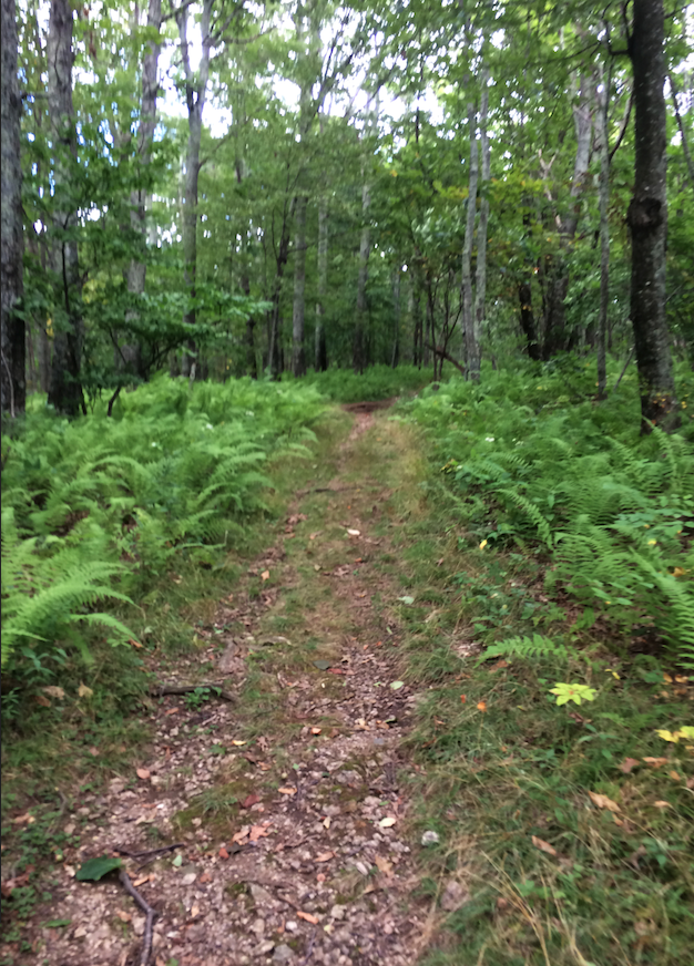
The trail on Pompey Mountain.
Being one with the tree on Mount Pleasant.
Another angle of the west vista.
My boyfriend and I drove from Lynchburg to Wiggins Spring Road in Amherst County and from there we followed the official signs designated by the National Forest Service for Mount Pleasant. If you don’t have a truck or some kind of raised vehicle, I wouldn’t recommend going down this road. The road was un-maintained and extremely rocky riding even in a truck. Finding the parking area was easy enough. We were greeted by silence, which can be novel in some of the more popular hiking areas.
There were two options for reaching the vista of Mount Pleasant via Henry Lanum Memorial Trail: out and back from the parking lot or taking a loop around over Pompey Mountain first. We opted for the loop around Pompey Mountain since it would be a similar distance and we wouldn’t see the same thing twice. I think we made the right choice. My coworker described this area as “a magical Ferngully-esque fairy forest” and I would have to agree. Ferns and flowers lined the quiet trail, making us feel as though we were entering another world. Also, this portion of the trail was much more challenging than the hike back to the car from the summit of Mount Pleasant so it was nice to get the most challenging part out of the way first. However, if you are a more inexperienced hiker or with children I recommend doing Mount Pleasant as an out and back hike from the parking lot.
Hiking Pompey Mountain was fun and scenic and included a nice climb challenge, but the real payoff was when we reached the intersection of the trail and trekked out to the summit. There are options for an east or west vista. We chose the west vista because it was recommended to us that this had the better views. When we came to the end of the trail, we had to scramble up over some large rocks to get the real payoff view. There were also a few small campsites that were close to the west vista. I could imagine this being a great place to camp overnight and watch the sunrise.
Although the east vista doesn’t offer the same views that the west vista does, it is much easier to reach and better for hiking with children. Also, if you are uncomfortable with rock scrambling the east vista may be better for you.To the right is a nice example of what you can expect to see if you brave the west vista.
I think it is important to note that my boyfriend and I noticed several signs of bears along the trail but did not see any of the bears. Tree markings and scat were frequent sightings along the entire Henry Lanum Memorial trail. That being said, stay aware while hiking this trail and carry bear spray easily accessible in case of an emergency. This is especially important in the Fall when bears are more active as they search for food in preparation for hibernation. If you see a bear at a distance, give the bear plenty of space to move along before continuing your hike.
We saw some families with children along the way, but they were ten years and older and appeared to have previous hiking experience. We even encountered a family with children who participated in backpacking. However, it is important to note that this was on the easier out and back portion of the trail. We did not see any families with children on the Pompey Mountain portion of the trail, likely because this is the most challenging part of making the Mount Pleasant loop.
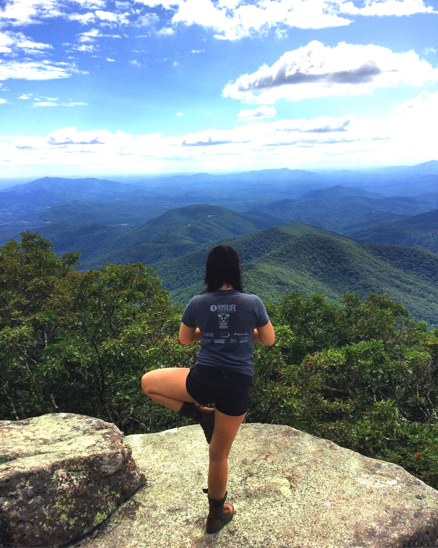
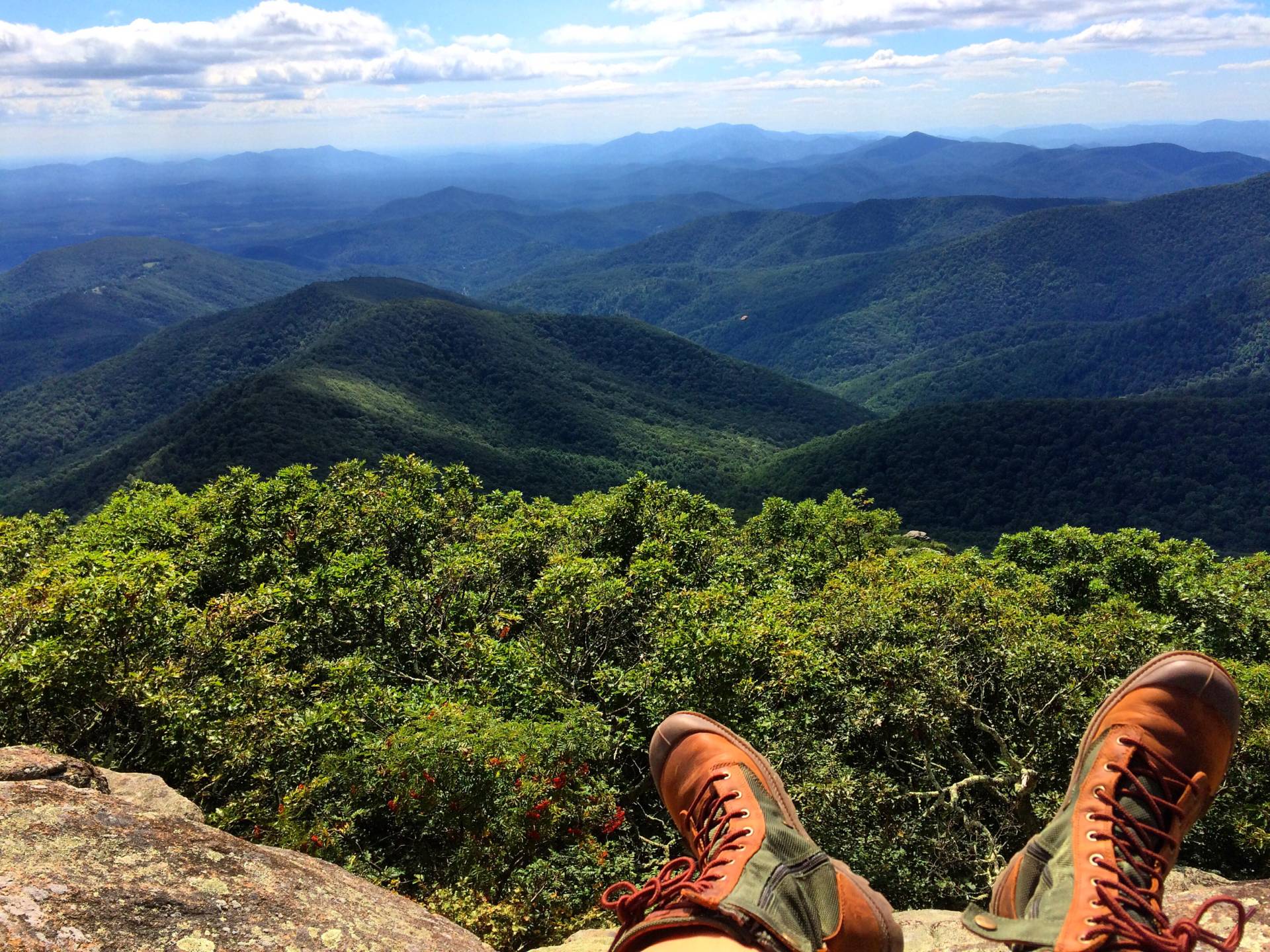
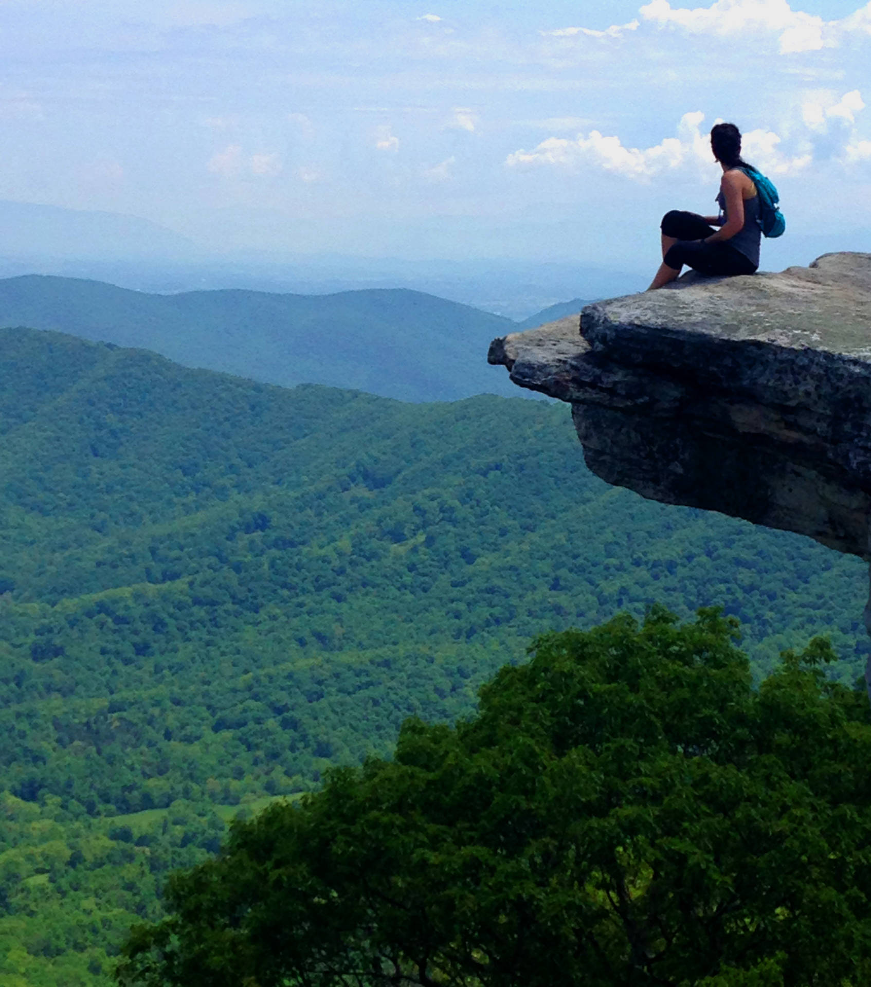
McAfee’s Knob | Moderate to Advanced Difficulty | Not Good for Children
One of the views you can expect when you get to the turnaround point on the trail.
McAfee’s Knob (pronounced MAC-afees) is the most photographed landmark on the Appalachian Trail for good reason. Not only are you treated to spectacular views at the top of the hike, but sitting at the edge of the overhang is an experience you won’t soon forget!
You’re going to have to earn that view though! Getting out to McAfee’s Knob means an 8.8 mile out and back hike with over 1700 feet of elevation gain along the Appalachian Trail. Definitely bring a CamelBak or at least two liters of water along with a lunch or larger snack. When you make it to the top, you’ll catch views of Catawba Valley, Tinker Cliffs, and North Mountain on your way to the ultimate view at McAfee’s Knob. Some folks even like to camp near the overlook to catch the sunrise or sunset. There are areas where camping is restricted, so check ahead of time before you go.
If you are into hiking for the solitude, you will definitely get some here. The top of Catawba Mountain where McAfee’s Knob is was pretty busy, but the way up left plenty of room for us to experience the quiet of nature. We passed other hikers on the trail from time to time, but for the majority of the time we had the trail to ourselves. We even had the opportunity to see some wildlife! We saw one Pygmy Rattle Snake and one Black Racer snake along with a whole slew of deer.
To get to the trail head, take I-81 to exit 141 to VA 419/311. Turn left at the stoplight and drive 0.3 mile to the light at the VA 311 junction. Turn right and continue 5.5 miles to the parking area on the left at the top of the pass. It took us about an hour to get here from where we live in North Lynchburg and it was absolutely worth it!